Short answer: Yes, in almost every case. A boundary survey shows where your property lines, corners, and easements actually are. A topographic survey shows how the ground rises, falls, and drains. Your designer uses both to place the house, your builder uses them to stake it, and together they cost far less than building in the wrong spot.
A survey is the least exciting check you will write on a home project. It is also one of the most important. Every decision about where your house goes rests on two facts: where your land starts and stops, and what the ground does in between. If either one is a guess, everything built on top of it is a guess too.
What does a land survey actually tell you?
A boundary survey is a licensed surveyor's professional determination of where your property is on the ground. It is more than a drawing. The surveyor researches the deed, plats, and corner records, then goes into the field to find the corners.
In Oklahoma, the state's minimum standards spell out what that work includes. The surveyor must establish or confirm a monument at every property corner, and the drawing must show easements and building lines from recorded plats, the width of any section-line rights-of-way, and inconsistencies like fences that do not sit on the line.
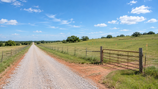
That last part matters more than people expect. On rural land, old fence lines often wander from the true boundary. A survey tells you before you set a house, a shop, or a septic field on a line that is not really yours.
What kinds of surveys will you hear about?
|
Survey |
What it shows |
When you need it |
|---|---|---|
|
Boundary survey |
Property lines, corners, easements, rights-of-way, encroachments |
Before you buy, and before design starts |
|
Topographic survey |
Ground elevations, contours, drainage paths, trees, existing structures |
Before design, especially on sloped or rural land |
|
Construction staking |
The house corners marked on the ground from the site plan |
Before excavation and the foundation |
|
Elevation certificate |
The building's elevation compared with the base flood elevation |
When the house is in or near a mapped flood zone |
|
Mortgage inspection report |
An approximate sketch prepared for a lender |
Closing on a loan, never for building |
You will not need all five on every project. Most rural builds need a boundary survey and a topographic survey before design, and staking before the foundation. An elevation certificate comes into play near a floodplain. FEMA notes that the certificate is completed by a land surveyor, engineer, or architect authorized by state or local law to certify elevations.
Is a mortgage inspection report the same as a survey?
No, and this one trips up a lot of buyers. A lender may order a mortgage inspection report at closing, and it can look like a survey. In Oklahoma, the rules say it must be labeled "Mortgage Inspection Report - Not a Land or Boundary Survey". Its required certificate states that it is not to be relied on for setting fence, building, or other improvement lines.
If the only drawing you have of your land came with your loan paperwork, assume you still need a boundary survey before you design.

When should you order the survey?
Ideally, before you close on the land. A boundary survey during your contract period shows you the real acreage, the easements, and whether anything is sitting on the line. If the numbers do not match the listing, you find out while you can still negotiate or walk away.
The topographic survey can come right after closing, before design starts. It is what tells your designer where the ground is high and dry, where water runs after a storm, and how much the site falls from one end of the house to the other.
On larger tracts, the boundary survey is held to a measurable accuracy. For Oklahoma rural tracts of 2 to 40 acres, the minimum standard allows a positional error of no more than half a foot. That is precise enough to place a house near a setback line with confidence.
How does a survey shape the design of your house?
This is where the survey pays for itself. With the boundary and the topography in hand, the house stops being a floor plan on a white page and becomes a building on your land.
- Placement. Setbacks, easements, the septic area, and the well all take up ground. The survey shows what is left for the house.
- Foundation. The slope decides whether a slab works, how much fill is needed, or whether a walkout basement makes sense.
- Finished floor height. The topography sets how high the floor needs to sit so water drains away from the house.
- Driveway. The survey shows the shortest buildable route from the road, and where it crosses an easement or a ditch.
At Fry Design Co, we model every home in 3D in Revit, so you can walk through it before construction begins, and any Fry Design Co plan can be modified to fit your lot. A garage can flip sides, or the house can turn to face the view. Our guides to how much land you need to build a house and what it costs to turn raw land into a buildable site cover the next questions.
What should you ask the surveyor for?
A clear request gets you a survey your designer and builder can actually use:
- A boundary survey with every corner set or confirmed, meeting your state's minimum standards.
- Easements and rights-of-way shown. Give the surveyor your title commitment so recorded easements can be located.
- A topographic survey of the building area, with contours, drainage paths, trees, and any existing structures, wells, or septic systems.
- The flood zone, and whether an elevation certificate will be needed.
- A digital file your designer can bring into the model, along with the signed drawing.
Ask for a written quote that names each item, so you know what you are getting.
Have a survey in hand, or about to order one? Book a design consultation, and we will fit your home to your land before anything is staked.
Frequently asked questions
Do I need a survey to build a house?
In almost every case, yes. A boundary survey confirms your property lines, corners, and easements, and a topographic survey shows the ground's slope and drainage. Designers, builders, lenders, and building departments rely on them to place and approve the house.
What is the difference between a boundary survey and a topographic survey?
A boundary survey locates property lines, corners, easements, and encroachments. A topographic survey maps the ground's elevations, contours, drainage, and features like trees and structures. Building on rural land usually calls for both.
Is a mortgage inspection report a survey?
No. In Oklahoma, it must be labeled as not a land or boundary survey, and its certificate says it is not to be relied on for fence, building, or other improvement lines. Order a boundary survey before you design.
When should I get a survey when buying land?
Before closing, during your contract period, so you can confirm acreage, easements, and encroachments while you can still negotiate. Order the topographic survey before design starts.
Do I need an elevation certificate?
You may if the house is in or near a mapped flood zone. It is completed by a surveyor, engineer, or architect authorized by law to certify elevations, and it can be required for floodplain permits and flood insurance.